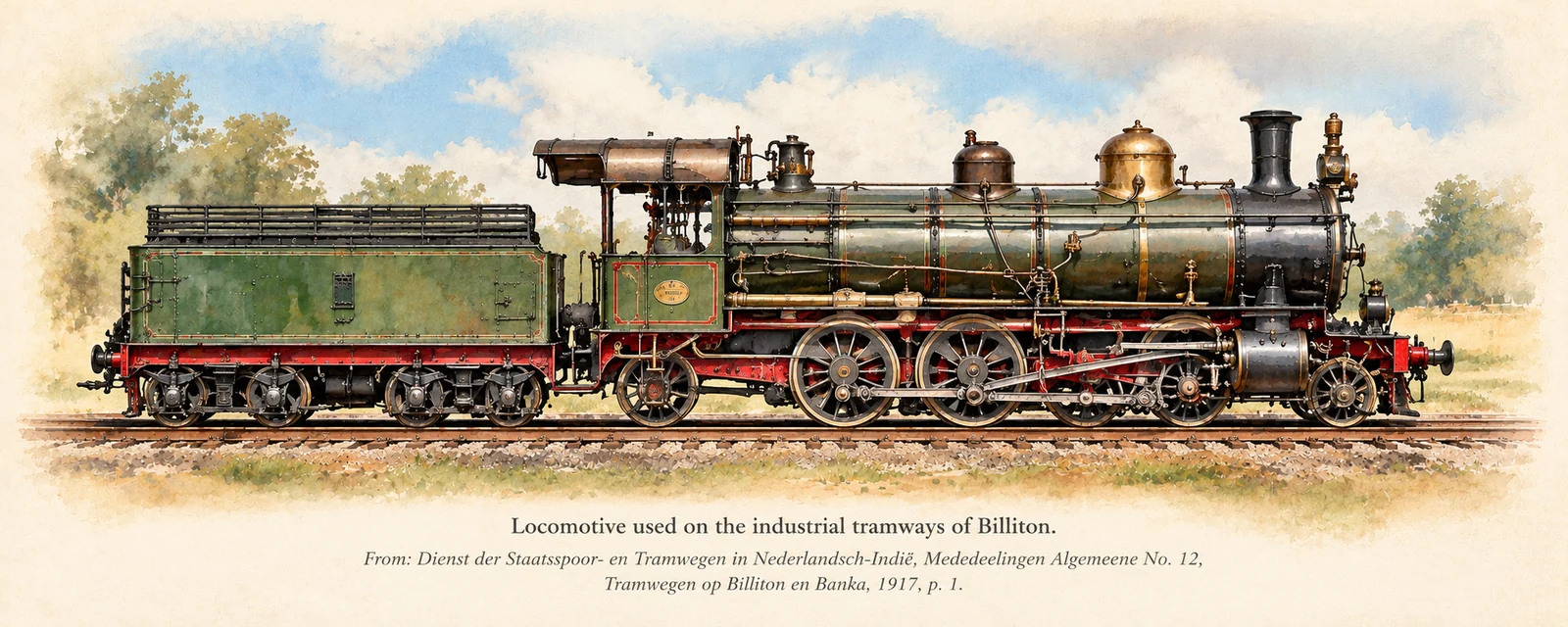
A forgotten transport network
By the time engineer M. Middelberg prepared his report in February 1916, the Billiton Maatschappij operated a substantial network of steam tramways serving mines, industrial sites and passengers. The report was published in May 1917 by the colonial State Railways and Tramways service.
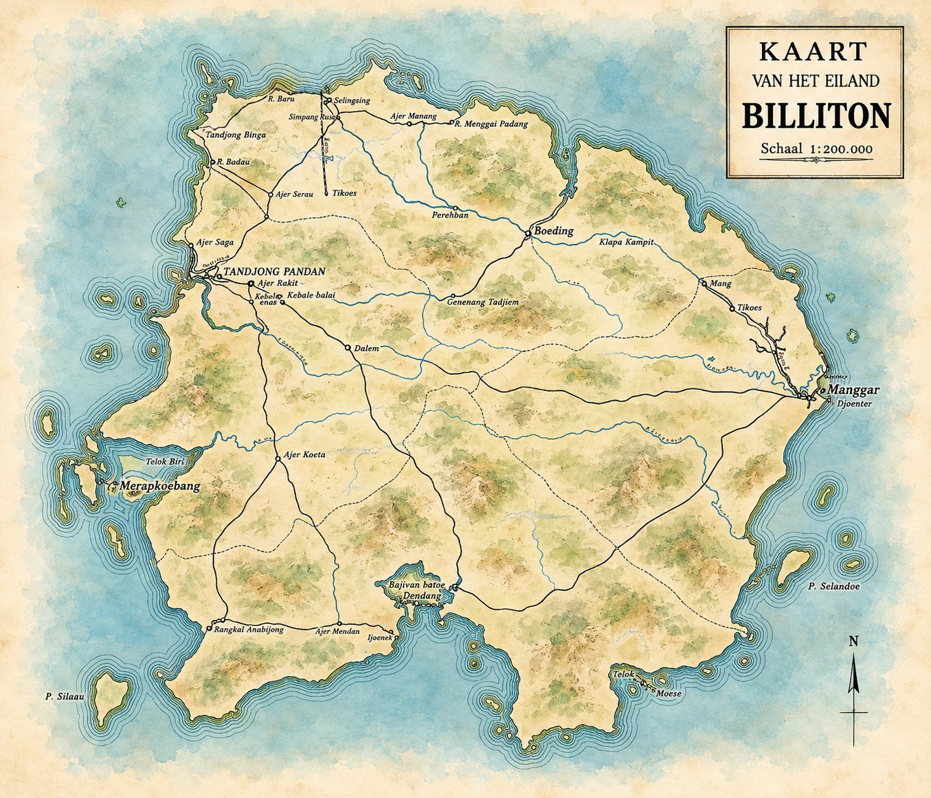
Billiton on a historical map
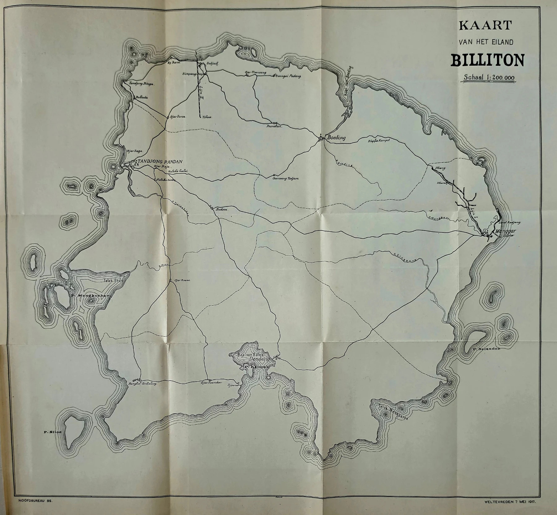
This historical map, dated May 1917, helps locate the island's settlements and transport corridors. The colourised version below is an artistic interpretation; some fine labels and line details may differ from the scanned original. Use the original map for historical verification.
View the original 1917 map (unaltered scan)
Historic tramway route diagram
This is a schematic route diagram, not a georeferenced railway map. It illustrates the route and named places described in the report. The branch lines are illustrative. Klapa Kampit is shown north-west of Mang as a proposed destination, not as a completed railway. The historical map above does not establish the exact track alignment.
Stations, mines and communities
The historical tariff table names several localities and industrial sidings. The precise location and alignment of each branch remain subjects for archival research.
| Location / name | Historical context |
|---|---|
| Lipat Kadjang | Important tramway and maintenance location in the Manggar area. |
| Manggar | Mining and settlement centre connected to the industrial transport network. |
| Merak and Mang | Names associated with the eastern tramway route in the historical report. |
| Tikoes | Mine served by a separate line reported to be approximately 11 km long. |
| Keling, Mangkoebang, Batoe Besie, Damar, Tempajang and Tongkeng | Examples of places listed in the original tariff material; precise railway positions need verification. |
| Klapa Kampit | A proposed extension mentioned in the report; not evidence that the extension was built. |
Who travelled on the tram?
The tramway was built primarily for the Billiton Maatschappij: it transported mining equipment, supplies, ore-related freight and company employees. The company's own regulations explicitly mention European, Chinese and indigenous personnel. Other people could travel when seats were available, after purchasing a ticket from the conductor. It was therefore an industrial tramway that also offered paid passenger transport, rather than a conventional public railway.
Recorded passenger fares (1916)
| Route or service | Fare per person |
|---|---|
| Manggar – Lipat Kadjang | ƒ 0.10 |
| Manggar – Merak | ƒ 0.25 |
| Merak – Mang | ƒ 0.10 |
| Northern line: workers riding freight trains | ƒ 0.25 |
These are historical Netherlands Indies guilder fares, not modern prices. Fares on the main line come from the appended Reglement voor de Stoomtram, printed p. 8. The northern-line charge is discussed on printed p. 6.
Timetable and passenger numbers
In 1915 the report recorded 70,300 paid passenger journeys and 552,800 journeys using subscriptions or free passes. Approximately ƒ 16,000 was collected in passenger revenue. The timetable provided eight trains in each direction daily between Manggar and Lipat Kadjang, and four in each direction between Manggar and Mang, with additional society trains on Wednesday and Saturday evenings.
Carriages, seats and locomotives
The open-sided passenger carriages had lengthwise benches with seating for four passengers on each side—eight across the two sides of that bench arrangement. The report does not establish the maximum number of passengers per complete carriage or per train, nor the number of carriages in a typical train. Separate carriages were provided for European passengers and for women, reflecting colonial-era arrangements.
The steam locomotives were described as two-axle machines weighing approximately eight metric tons in working order, with Walschaerts valve gear. The report does not identify their manufacturer, model, build year, or a definitive withdrawal date. The main line was operating by approximately 1886; it was still active when inspected in 1916.
Workshops and safety
The company's workshop at Lipat Kadjang maintained the locomotives and rolling stock. A conductor travelled on each passenger train, and tickets were sold aboard. The report also discusses safety concerns and accidents, including a fatal incident involving an inexperienced fireman. These details help document both everyday travel and the risks faced by railway workers.
Primary historical source
M. Middelberg, “Tramwegen op Billiton,” report dated 4 February 1916, published in Tramwegen op Billiton en Banka, Mededeelingen Algemeene No. 12, Dienst der Staatsspoor- en Tramwegen in Nederlandsch-Indië, Batavia, May 1917. See especially printed pp. 2–8 for route lengths, passenger numbers, carriage descriptions, operating rules and fares.
Editorial note: The illustrated locomotive and colourised map are modern artistic reconstructions, not archival reproductions. The original map is provided above for comparison. Exact railway alignments and some place-name readings require further checking.