BILLITON HERITAGE · AN ACCOUNT FROM 1954
Langkuas Lighthouse
The story behind a light on Billiton’s northern sea route
Today, visitors come to Lengkuas Island for its white sand, granite boulders and the slender lighthouse rising above the palms. But the tower was built for a much more demanding purpose: to help mariners find their way through waters filled with reefs, islands and shallows. An illustrated article published in Erts in 1954 lets us look back at the lighthouse as a working maritime outpost.
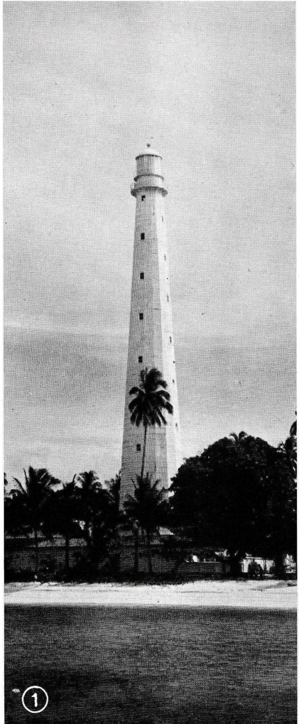
1. Why was there a lighthouse here?
In his article “Lichtend Langkuas”, engineer Ir. J. F. W. van der Meulen describes the sea routes linking the South China Sea, the Java Sea and the waters around Bangka and Billiton. For ships passing the northwestern coast of Billiton, Langkuas was an important point of reference. By day, the tower marked the island; after dark, its light offered guidance in a region where coral reefs demanded careful navigation.
Van der Meulen writes of seeing the tower from a boat approaching the island. The light-coloured structure gradually becomes distinct above the low vegetation. He also warns that the waters and shores around Langkuas are not a place for careless landing: coral and shallow patches make the approach difficult.
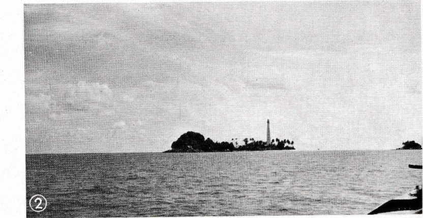
2. A remarkable iron tower
The lighthouse stood approximately 72 metres high. Rather than being built as an ordinary masonry tower, it was assembled from cast-iron plates. According to the article, these components were manufactured in the Netherlands, shipped to the East Indies and put together on the island. Van der Meulen was impressed by the engineering, particularly the effort required to produce and fit the iron sections so far from the place where they had been made.
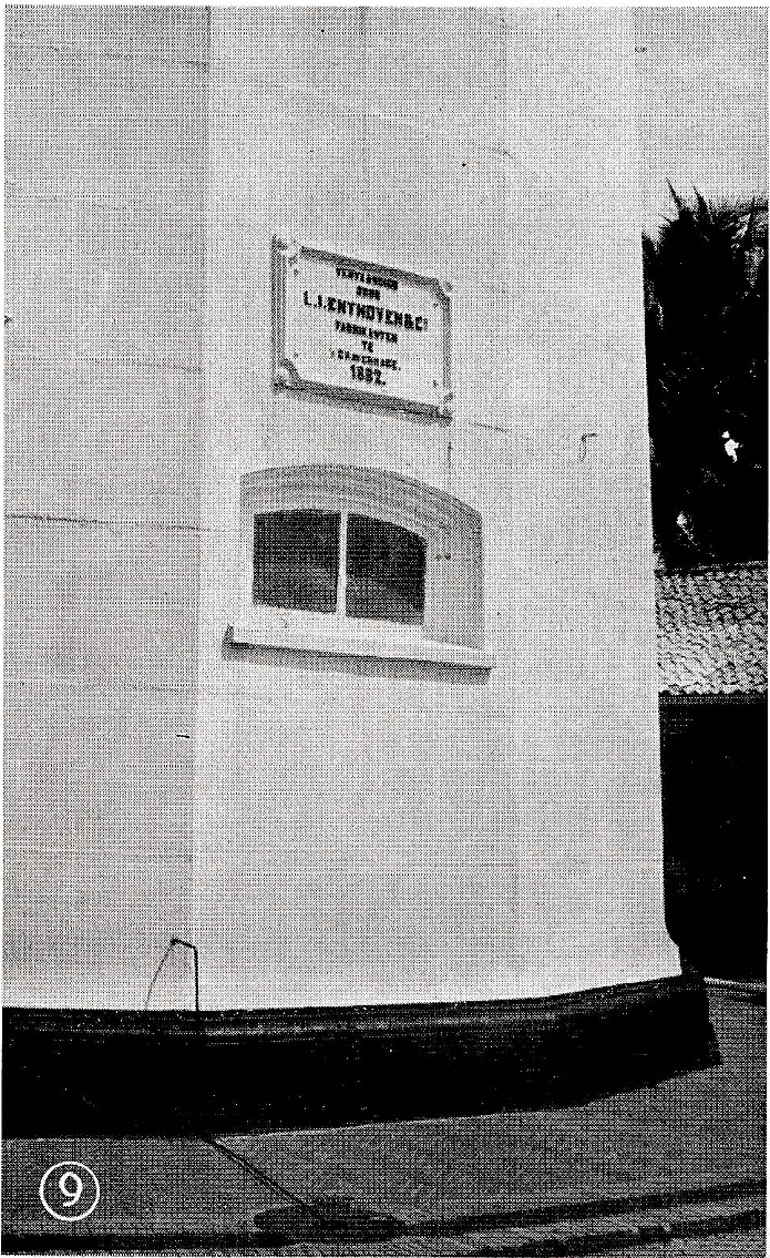
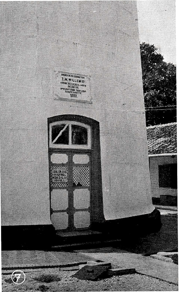
He describes the lighthouse as already about 72 years old when he visited in the 1950s. A maker’s plate photographed on the tower carries the year 1882, valuable evidence of its nineteenth-century origins. That date should be understood as a date shown on the surviving plate, however; the article does not independently establish an exact inauguration day.
3. An island of granite, sand and coral
The 1954 account makes clear that Langkuas was not simply a picturesque little island. Its western side was dominated by large, weathered granite rocks, while the eastern shore was lower, with white sand and coastal growth. A shallow channel and the surrounding reefs influenced how visitors could land. Even in the mid-twentieth century, the island’s character was shaped by its exposed position at sea.
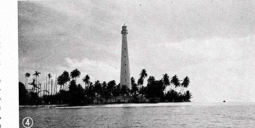
4. The people who kept the light burning
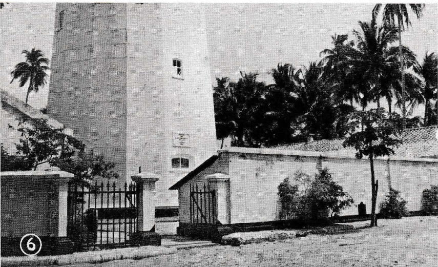
Maintaining a lighthouse on a small island meant living with practical limitations. Van der Meulen describes a residence and service buildings grouped around the tower, enclosed within a rectangular compound. Their doors and iron fittings reflected the functional character of the station. In the past, the lighthouse keepers and their families depended on arrangements that are easy to overlook when looking at the island today.
Fresh water was especially important. The buildings were designed to collect rainwater for use by the inhabitants, because a dependable natural source of drinking water was not available on the island. Food and other supplies also had to come from elsewhere, including Billiton. The lighthouse was therefore not just a tower: it was a small, self-contained workplace and home.
5. How the light worked
The article also looks inside the lighthouse. The tower was fitted with a rotating optical apparatus, lenses and a mechanical system driven by weights. The arrangement required attention and maintenance from the keepers. Van der Meulen describes a light characteristic with a 120-second cycle and a brief visible flash. He also refers to the light’s visibility over a considerable distance at sea.
Such details explain why the lighthouse mattered to shipping. Its characteristic flash was not merely a bright point on the horizon; it helped navigators recognise which light they were seeing.
6. Looking out towards Billiton
For Van der Meulen, climbing the tower offered a reward beyond its technical interest. From the gallery he could see Billiton’s coast, the smaller islands and the shallow coral waters around Langkuas. He describes changing shades of blue and the outlines of reefs beneath the sea. His account ends with the conviction that the island’s light would continue to guide ships and their crews.
Nearly three-quarters of a century after his article appeared, the historical photographs help us see the island not only as a destination, but as part of Billiton’s maritime history. The tower’s origin, the work of its keepers and the risks faced by passing vessels are all part of the story visitors can discover here.
About this historical account
Primary source: Ir. J. F. W. van der Meulen, “Lichtend Langkuas,” Erts – Maandblad der Billitonbedrijven (1954), pp. 241–245. The photographs are reproduced from the supplied archival scans; they have not been colourised or artistically reconstructed. Their edges are softened only in the page design.
Names: The historical article uses Langkuas and Billiton; modern usage commonly includes Lengkuas and Belitung. This article presents the author’s observations as a 1954 account, not as a survey of present-day conditions.